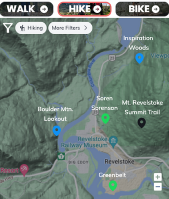
Gudtrails are trail maps that are easy to update, free to use, and work offline, helping visitor centres and other trail managers create the best local trail maps for print, download and online use. We collect info from local land managers and update it instantly on public maps that can be viewed on phone or desktop, exported for download before heading into the backcountry, and printed for handing out at visitor centres.